
City Berlin Elevation 60 m (200 ft) Area 6.65 km² | State Berlin Founded 1375 Time zone CET/CEST (UTC+1/+2) | |
 | ||
Karow is a German locality (Ortsteil) within the Berlin borough (Bezirk) of Pankow. Until 2001 it was part of the former Weißensee borough.
Contents
Map of Karow, 13125 Berlin, Germany
History
The locality was first mentioned in 1375 with the name of Kare. Autonomous Prussian municipality of the former Niederbarnim district, Karow was incorporated into Berlin in 1920, with the "Greater Berlin Act".
Overview
Located in the north-eastern suburb of Berlin, it borders with the localities of Buch, Französisch Buchholz, Blankenburg and Stadtrandsiedlung Malchow. It also borders, on the east, with the Brandenburger town of Ahrensfelde, in the district of Barnim. Part of its territory, close to the natural reserve Karower Teiche (in Buchholz) is included in Barnim Nature Park.
Subdivision
Karow counts 1 zone (Ortslage):
Transport
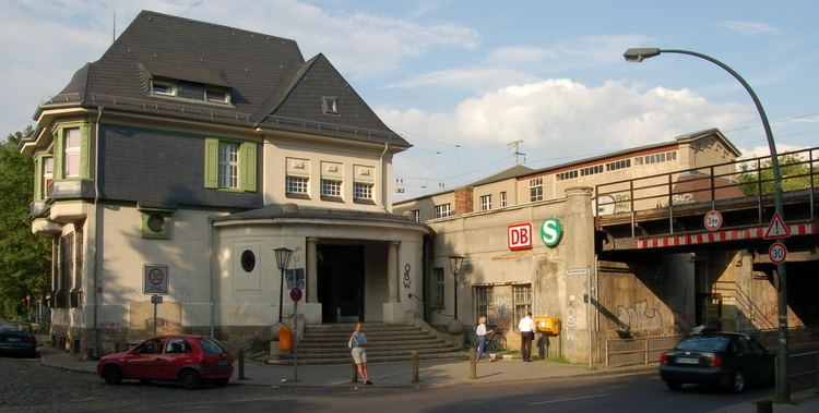
The locality is served by the S-Bahn station of Karow, on the line S2. This station is also the endpoint of a local railway, the Heidekrautbahn.
The Berliner beltway (A10, known as "Berliner Ring") crosses Karow and separates it from Buch. An exit serving the quarter (n.3 "Bucher Straße") is located on the short motorway A114.