
Area rank 315 in Norway Area 229.9 km² Local time Friday 5:32 PM | Demonym(s) KarmøybuKartabu Population 42,062 (2015) Number of airports 1 | |
 | ||
Weather 6°C, Wind SW at 8 km/h, 85% Humidity | ||
opplev karm y 4k norwegian version
Karmøy is a municipality in Rogaland county, Norway. It is located southwest of the city of Haugesund in the traditional district of Haugaland. The administrative centre of the municipality is the town of Kopervik.
Contents
- opplev karm y 4k norwegian version
- Map of KarmC3B8y Norway
- krasand 01 05 15 in norway karm y
- General information
- Name
- Coat of arms
- Churches
- History
- Geography
- Government
- Municipal council
- Area attractions
- Industry
- Twin towns Sister cities
- Notable residents
- References
Map of Karm%C3%B8y, Norway
Karmøy is one of the largest municipalities in the region with over 42,000 people. It is known for its industries, as well as for fishing. Karmøy is also well known in Norway for its beautiful heather moors and the white sand surfing beaches.
Most of the municipality lies on the island of Karmøy. The island is connected to the mainland by the Karmøy Tunnel and the Karmsund Bridge.
krasand 01 05 15 in norway karm y
General information
The municipality of Karmøy is a recent creation. It was created as a new municipality on 1 January 1965 upon the merger of two towns and parts of five municipalities into one large municipality. The merger was instigated by the findings of the Schei Committee. Karmøy was the result of merging the towns of Kopervik and Skudeneshavn plus the neighboring municipalities of Skudenes, Stangaland, Åkra, and most of Avaldsnes and Torvastad. Initially, the municipality had 23,217 residents.
Name
The municipality was named after the island of Karmøy, on which the majority of the municipality is located. The Old Norse form of the name was Kǫrmt. The name is probably derived from karmr which means "bargeboard" (here in the sense "the sheltering island"). The last element in the word, øy, means "island" and was added later.
Coat-of-arms
The coat-of-arms is from modern times; they were granted on 18 April 1975. The arms are a silver or white diamond interwoven with a cross on a red background. The diamond symbolizes the name Karmøy since the island protects the mainland. The cross symbolizes the historic Avaldsnes Church which was a royal chapel in the Middle Ages.
Churches
The Church of Norway has eight parishes (sokn) within the municipality of Karmøy. It is part of the Karmøy deanery in the Diocese of Stavanger.
History
There are several finds from the Stone Age, Bronze Age and Iron Age. Large burial mounds, stone monuments, and many other ancient monuments are found on the island. Karmøy is the site of the Storhaug, Grønhaug, and Flagghaugen burial mounds.
Karmøy was known for sailing in the old times. The eddic poem Grímnismál says that Thor, the weather god, wades the Karmsundet strait every morning on his way to Yggdrasil, the tree of life. The ocean outside Karmøy is dangerous, filled with underwater currents and rocks. Thus the ships were forced into the narrow Karmsundet. Chieftains and kings controlled the ships passing up and down the coast and demanded taxes.
The Karmsundet strait was also the source of the name of the kingdom, at the time when the first king of the unified Norway, Harald Fairhair, lived on Karmøy. (See History of Norway.)
Avaldsnes is located on the northeastern coast of the island. King Augvald who has given his name to this ancient site is mentioned in the Old Norse sagas as having his home here. Later the residence of Harald Fairhair and other kings are mentioned. There is also a medieval church, St. Olav's church of Avaldsnes, located on this coast.
Visnes, a village in the northwest of Karmøy was once the site of an important copper mine. This mine was source of the copper used for the Statue of Liberty in New York City.
In the 18th century, two girls from Uyea in Shetland rowed to Haaf Gruney to milk some of the cows grazing there. Unfortunately, their return was marred by a strong storm, and eventually they found their tiny boat blown to Karmøy. The Uyea girls ended up marrying Karmøy men, and their descendants still live there. The Dyrland family of Karmoy are believed to be the family that the two girls married into after they arrived on Karmoy. Sivert Dyrland was a member of the Norwegian government in the early 20th century.
Geography
The majority of the municipality is located on the large island of Karmøy, but it also includes the mainland peninsula between the Karmsundet strait and Førresfjorden, plus the island of Feøy and several other small islands.
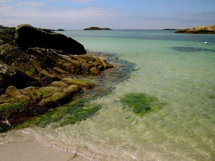
The natural and cultural landscape is highly heterogeneous, encompassing chalk-white sands, moorland, and several piers around the island. The landscape in the north is mainly agricultural, while large parts of the inland south are heather moors. The island has many white, sandy beaches facing the North Sea, attracting surfers as one of the top spots for windsurfing in Norway.
Towns and villages are mostly located along the coast. The three towns in Karmøy are all on the island, the administrative center Kopervik is on the east side, Åkrehamn is on the west side, while Skudeneshavn is on the southern tip. On the mainland part of Karmøy, the village of Norheim is contiguous with the neighboring town of Haugesund. To the south of Norheim is the village of Vormedal while the village of Kolnes is in the northeastern part of mainland Karmøy. Other villages in Karmøy include Avaldsnes, Eike, Ferkingstad, Sævelandsvik, Sandve, Veavågen, and Visnes.
Haugesund Airport is also located on the island rather than in the town of Haugesund proper. The Geitungen Lighthouse lies at the southern end of the municipality, marking the entrance to the Boknafjorden.
Government
All municipalities in Norway, including Karmøy, are responsible for primary education (through 10th grade), outpatient health services, senior citizen services, unemployment and other social services, zoning, economic development, and municipal roads. The municipality is governed by a municipal council of elected representatives, which in turn elect a mayor.
Municipal council
The municipal council (Kommunestyre) of Karmøyis made up of 17 representatives that are elected to every four years. For 2015–2019, the party breakdown is as follows:
Area attractions
Industry
Norsk Hydro is a large aluminium smelter operator located on the island of Karmøy. The power supply of this facility is done by three overhead power lines, which cross the Karmsundet strait on 143.5-metre (471 ft) tall pylons. These pylons are the tallest electricity pylons in Norway.
Bauer-Nilsen design and produce high-pressure hydraulics located at Karmøy.
Twin towns – Sister cities
Karmøy has sister city agreements with the following places: