
Width 8.5 km (5.28 mi) Highest point Søre Sålefjell Elevation 132 m | Length 30 km (19 mi) Highest elevation 132 m (433 ft) Area 176.8 km² | |
 | ||
Points of interest Nordvegen History Centre, Haugaland Zoo, Karmøy Fiskerimuseum, HKB 3/978 Syre, Fishermen's Memorial | ||
Karmøy (locally called Karmøyne or Karmøynå) is an island in the northwestern part of Rogaland county, Norway. The 176.8 square kilometres (68.3 sq mi) island makes up the majority of the municipality of Karmøy, along with the islands of Feøy, some smaller surrounding islands, and part of the mainland south of Haugesund. It is the largest island in Rogaland county. The island is separated from the mainland by the Karmsundet strait. The Boknafjorden lies to the south and southeast of the island. The Sirafjorden lies to the west, separating Karmøy from the islands of Utsira and Feøy.
Map of Karm%C3%B8y, Norway
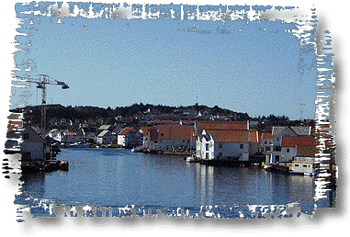
The island of Karmøy is the location of the towns of Kopervik, Skudeneshavn, and Åkrehamn. The island has a population of about 33,101 people (2014). The island is connected to the mainland by the Karmsund Bridge in the north and the Karmøy Tunnel in the central part. There is a regular ferry connection from Skudeneshavn on the southern tip of Karmøy that crosses the Boknafjorden to Kvitsøy and on to Randaberg and Stavanger. Haugesund Airport, Karmøy is located on the island at the western terminus of the European route E134 highway.