
Elevation 275 m Population 293 (2014) | Traditional region Styria Municipality Prebold Area 3 km² | |
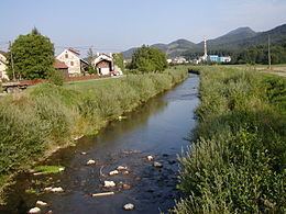 | ||
Kaplja Vas ([ˈkaːplja ˈʋaːs]; Slovene: Kaplja vas) is a settlement in the Municipality of Prebold in east-central Slovenia. The village core lies on the flatlands on the right bank of the Savinja River northwest of Prebold and its territory extends into the hills to the south, to the top of Fat Peak (Slovene: Tolsti vrh, 756 m). Traditionally the area was part Styria. The entire municipality is now included in the Savinja Statistical Region.
Map of 3312 Kaplja Vas, Slovenia
References
Kaplja Vas, Prebold Wikipedia(Text) CC BY-SA