
Country Japan - Tree Osmanthus fragrans Area 11.09 km² Local time Friday 7:32 AM | District Ama - Flower Japanese iris Population 36,789 (May 2015) Prefecture Aichi Prefecture | |
 | ||
Region Chūbu region
Tōkai region Time zone Japan Standard Time (UTC+9) Weather 6°C, Wind NW at 14 km/h, 88% Humidity Points of interest Owari Onsen Tokai Ce, Genjiizumi Ryokuchi Park, Ryūshō‑in Temple | ||
Kanie (蟹江町, Kanie-chō) is a town located in Ama District, Aichi Prefecture, Japan. As of May 2015, the town had an estimated population of 36,789 and a population density of 3320 persons per km². The total area was 11.09 square kilometres (4.28 sq mi).
Contents
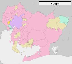
- Map of Kanie Ama District Aichi Prefecture Japan
- Etymology
- History
- Geography
- Neighboring municipalities
- Economy
- Education
- Railway
- Highway
- Sister city relations
- Local attractions
- References
Map of Kanie, Ama District, Aichi Prefecture, Japan
Etymology
The origin of the town's name comes from the once-plentiful crab (蟹, kani) population.
History
Kanie Town was created with the establishment of the municipalities system on April 1, 1889. In October 2003, Kanie participated in discussions with regards to a possible merge with neighboring town of Yatomi and village of Jūshiyama. However, negotiations failed in 2004 and Kanie decided to remain as an independent municipality.
Geography
Kanie is located in the southwest Aichi Prefecture. All of the town is at sea level.
Neighboring municipalities
Economy
Kanie is primarily a regional commercial center and bedroom community for the Nagoya metropolis.
Education
Middle schools
Elementary schools