
Area 119.5 km² Population 9,830 (1 Apr 2005) | Local time Saturday 8:38 PM | |
 | ||
Time zone Japan Standard Time (UTC+9) Weather 0°C, Wind SW at 18 km/h, 89% Humidity Points of interest Takayama Uichi Memorial, Komakionsen Shibusawa Park, Icho Park, Tateno Park, Shichinohe Castle | ||
Kamikita (上北町, Kamikita-machi) was a town located in Kamikita District in central Aomori Prefecture, Japan.
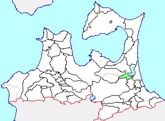
Map of Kamikita District, Aomori Prefecture, Japan
On March 31, 2005, Kamikita was merged into the neighboring and expanded town of Tōhoku, and thus no longer exists as an independent municipality.
Kamikita Village was founded in 1889 through the merger of Ōura, Shingo and Shindate Villages. On September 1, 1958 it was elevated to town status.
Bordering the east shore of Lake Ogawara, the town had an agriculture-based economy based on production of rice, tobacco, carrots as well as lake fish, including smelt, icefish and shijimi.
At the time of its merger, the town had an estimated population of 9,830 and a population density of 82.27 persons per km². The total area was 119.48 km².
Kamikita was served by two train stations: Kamikitachō Station and Kogawara Station on the Tōkaidō Main Line.