
Country United States FIPS code 16-42400 Elevation 378 m Local time Saturday 4:00 AM Area code 935 (208 Exchange) | Time zone Pacific (PST) (UTC-8) GNIS feature ID 0396726 Zip code 83536 Population 1,320 (2013) | |
 | ||
Weather 6°C, Wind N at 5 km/h, 95% Humidity Area 3.03 km² (2.797 km² Land / 23 ha Water) | ||
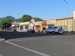
Welcome to kamiah idaho
Kamiah (/ˈkæmi.aɪ/ KAM-ee-eye) is a city in Idaho and Lewis counties in the U.S. state of Idaho. The largest city in Lewis County, it extends only a small distance into Idaho County, south of Lawyer Creek. The population was 1,295 at the 2010 census, up from 1,160 in 2000. The city lies in the narrow valley of the Clearwater River; downstream are Orofino and Lewiston, at the confluence with the Snake River.
Contents
- Welcome to kamiah idaho
- Map of Kamiah ID 83536 USA
- Forest fire kamiah idaho 2015
- History
- Geography
- Climate
- References
Map of Kamiah, ID 83536, USA
Forest fire kamiah idaho 2015
History
The Kamiah area has been inhabited by the Nez Perce for centuries. The name "Kamiah" is Nez Perce for "many rope litters," as Nez Perce manufactured "Kamia" ropes in the area to fish steelhead. Also according to Nez Perce tradition, the Appaloosa horse was first bred in the area.
On their return trip east, the Lewis and Clark Expedition camped in the Kamiah area for several weeks during the spring of 1806, waiting for snows to melt.
Kamiah is the character name of the Nez Perce/Blackfoot woman in Across the Wide Missouri, a 1951 'mountain men' film set in the 1830s. Similar in fame to Sacagawea of the Lewis & Clark expedition, Kamiah led her associated mountain men's troop over the Bitterroot Range to her homeland (Three Forks, Montana for Sacagawea).
Hohots Ilppilp was the leader around Kamiah from at least the time of Lewis and Clark until the 1840s. When the first leader for all the Nez Perce was appointed, it was Hohots Ilppilp's grandson Ellis who lived in this area and maintained large herds of sheep, cattle and over a thousand horses.
Kamiah is within the Nez Perce Indian Reservation. Similar to the opening of lands in Oklahoma, the U.S. government opened the reservation for white settlement 122 years ago in November 1895. The proclamation had been signed less than two weeks earlier by President Cleveland.
Geography
Kamiah is located at 46°13′37″N 116°1′40″W (46.226811, -116.027728), at an elevation of 1,240 feet (378 m) above sea level.
According to the United States Census Bureau, the city has a total area of 1.17 square miles (3.03 km2), of which 1.08 square miles (2.80 km2) is land and 0.09 square miles (0.23 km2) is water.
Climate
According to the Köppen climate classification system, Kamiah has a hot-summer continental climate (Köppen Dfa).