
Population 21,793 (1 May 2008) Local time Saturday 7:53 PM | Area 369.1 km² | |
 | ||
Time zone Japan Standard Time (UTC+9) Weather 6°C, Wind S at 3 km/h, 85% Humidity | ||
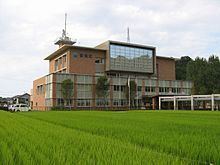
Kami (香美町, Kami-chō) is a town located in Mikata District, Hyōgo Prefecture, Japan.
Contents
Map of Kami, Mikata District, Hy%C5%8Dgo, Japan
The town was formed on April 1, 2005 from the merger of the former town of Kasumi, from Kinosaki District, and the towns of Mikata and Muraoka, both from Mikata District.
As of May 1, 2008, the town has an estimated population of 21,793. The total area is 369.08 km².
Kami lies entirely within the central part of San'in Kaigan Geopark.
Geography
Kami Town consists of 3 wards; Kasumi (香住), Muraoka (村岡), and Ojiro (小代).
Ojiro is designated as one of the Most Beautiful Villages in Japan, and is the birthplace of Tajiri-go, a Tajima Cattle who is the ancestor of more than 99.9% of Japanese Black wagyu.
This town is also the location of the Amarube Bridge, a famous railroad trestle bridge, and of the Tajima Plateau Botanical Gardens.