Source elevation 975 m | River mouth Jizera | |
 | ||
Similar Jizera Mountains, Zřícenina hradu Návarov, Darretalsperre, Riegrova stezka, Dolomithöhlen von Bozkov | ||
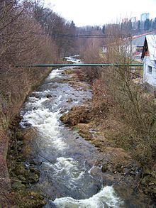
Kamenice river (German: Kamnitz) is a tributary of the Jizera river in the Czech Republic. It rises from several source streams in the Jizera Mountains (German: Isergebirge) of Bohemia at Holubník (the "pigeon-house") (1070 m). Below the former crystal production village of Kristiánov (Christiansthal), a locality in the Bedřichov (Friedrichswald), only Liščí bouda (Fuchsbaude) remains preserved as a glass museum near where the Kamenice meets the Josefův Důl dam. The Josefův Důl dam, above the village Josefův Důl, was built between 1976 and 1982 and is the largest dam in the Jizera Mountains. It has a height of 43 m and a capacity of 23 million cubic meters. It is used for drinking water, so recreational activities are not permitted upon it.
Map of Kamenice, Czechia
The Kamenice flows on its course south of the city Tanvald (German: Tannwald), where it meets the Desná river (German: Desse). It flows on through Velký Hamr (German: Großhammer). After 36 km it flows through the village of Spálov u Semil (German: Spalow) near Železný Brod (German: Eisenbrod) in the Jizera Mountains. The Kamnitz is the largest tributary of the Jizera.
On July 29, 1897, a severe flood of the region occurred following the swelling of the Kamenice because of 310 mm/m² of rainfall in the Jizera Mountains that day. The breakup of the bílý Desná dam on September 18, 1916 was also caused by the flooding of the Kamenice.
