
Country Russia Length 1,805 km (1,122 mi) | River mouth Volga River | |
 | ||
Main source Udmurtia
360 m (1,180 ft) Basin size 507,000 km (196,000 sq mi) Discharge Average rate:
4,100 cubic metres per second (140,000 cu ft/s) | ||
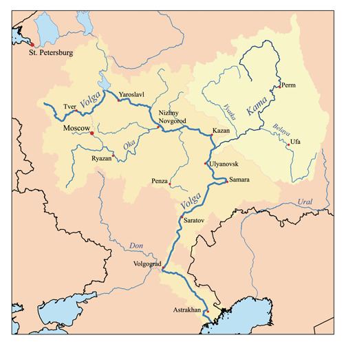
The Kama (Russian: река́ Ка́ма, [ˈkamə]; Tatar: Чулман, Çulman; Udmurt: Кам) is a major river in Russia, the longest left tributary of the Volga and the largest one in discharge; it is larger than the Volga before their junction.
It starts in the Udmurt Republic, near Kuliga, flowing northwest for 200 kilometres (120 mi), turning northeast near Loyno for another 200 kilometres (120 mi), then turning south and west in Perm Krai, flowing again through the Udmurt Republic and then through the Republic of Tatarstan, where it meets the Volga.
The Kama is 1,805 kilometres (1,122 mi) long.
Before the advent of the railroads, the Kama was connected by important portages with the basins of the Northern Dvina and the Pechora. In the early 19th century, Northern Ekaterininsky Canal connected the upper Kama with the Vychegda River (a tributary of the Northern Dvina), but was mostly abandoned after just a few years due to low use.
The Kama was featured in the 2013 Russian film The Geographer Drank His Globe Away, in the climactic rapids scene.
Dams and reservoirs
The Kama is dammed at several locations: