
Admin. region Köln Elevation 399 m (1,309 ft) Population 11,817 (31 Dec 2010) | Time zone CET/CEST (UTC+1/+2) Local time Saturday 5:54 AM | |
 | ||
Weather 6°C, Wind W at 32 km/h, 89% Humidity Points of interest AKTIVI Kinder Abenteuerland, Ausweichsitz Nordrhein‑Westfalen, Stolzenburg | ||
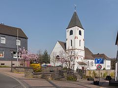
Kall is a municipality in the district of Euskirchen in the state of North Rhine-Westphalia, Germany. It is located in the Eifel hills, approximatively 20 km south-west of Euskirchen.
Map of Kall, Germany
Kall consists of the following districts: Anstois, Benenberg, Diefenbach, Dottel, Frohnrath, Gillenberg, Golbach, Keldenich, Krekel, Rinnen, Roder, Rüth, Scheven, Sistig, Sötenich, Steinfeld, Steinfelderheistert, Straßbüsch, Urft, Wahlen, Wallenthal, Wallenthalerhöhe, and Kall itself.
References
Kall, North Rhine-Westphalia Wikipedia(Text) CC BY-SA