
Phone number 0224-63-2111 Population 29,846 (Sep 2015) | - Flower Japanese Gentian Area 147.5 km² Local time Saturday 7:15 AM | |
 | ||
Weather 3°C, Wind W at 14 km/h, 77% Humidity Points of interest Daiyama Park, Kōzō‑ji, Kakuda Homeland History M, Chōsen‑ji Temple, Tokura‑ji Temple | ||
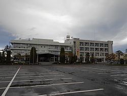
Kakuda (角田市, Kakuda-shi) is a city located in Miyagi Prefecture, in the Tohoku region of northern Japan. As of September 2015, the city had an estimated population of 29,846 and a population density of 202 persons per km². The total area was 147.58 square kilometres (56.98 sq mi).
Contents
- Map of Kakuda Miyagi Prefecture Japan
- Geography
- Neighboring municipalities
- History
- Economy
- Education
- Railway
- Highway
- Sister city relations
- Local attractions
- Noted people from Kakuda
- References
Map of Kakuda, Miyagi Prefecture, Japan
Geography
Kakuda is in southeastern Miyagi Prefecture. The Abukuma River flows through the city.
Neighboring municipalities
History
The area of present-day Kakuda was part of ancient Mutsu Province, and was the location of Kakuda Castle during the Sengoku period, which was ruled by the Ishikawa clan as a subsidiary 10,000 koku domain to Sendai Domain during the Edo period under the Tokugawa shogunate.
The town of Kakuda was established with the creation of the municipalities system on April 1, 1889. It annexed the neighboring villages of Kitago, Sakura, NIshine, Higashine, Fujio, and Edano on October 1, 1954. Kakuda was raised to city status on October 1, 1958.
Economy
Kakuda has a mixed economy based on light manufacturing of automotive parts and electrics, and on agriculture, primarily the cultivation of soybeans and plums. The area was traditionally noted for its sericulture.
Education
Kakuda has eight elementary schools, three middle schools, one high school and one special education school.