
Alternate name Kaimu Beach Park | Local time Friday 9:28 AM | |
 | ||
Weather 26°C, Wind N at 11 km/h, 63% Humidity | ||
Kaimū was a small town in the Puna District on Island of Hawaiʻi that was completely destroyed by an eruptive flow of lava from the Kūpaʻianahā vent of the Kīlauea volcano in 1990. In Hawaiian, kai mū means "gathering [at the] sea" as to watch surfing. The lava flow that destroyed Kaimū and nearby Kalapana erupted from the southeast rift zone of Kīlauea.
Contents
Map of Kaimu, Hawaii 96778, USA
Before volcanic destruction
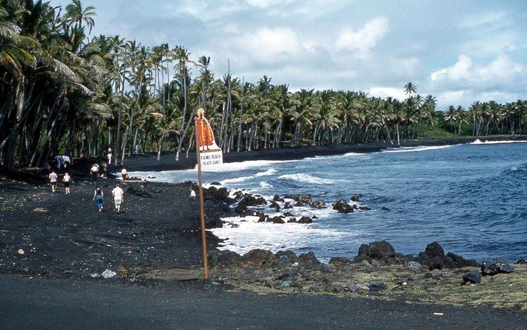
Kaimū was located on Kaimū Bay. The bay was noteworthy for its black sand beach which was surrounded by shady palm trees.
After volcanic destruction
Now both the bay and the town are buried under some 50 feet (15 m) of lava. A large section of State Route 130 (Kaimu-Chain of Craters Road) was also covered by the lava. The road is on top of the cooled lava now, with some homes built on top of the lava. There is also the New Beach, black sand like the old, where locals and visitors are bringing sprouted coconuts and planting them to restore the lost trees.