
Area 242 sq mi (630 km) | Established 1929 | |
 | ||
Location Potaro-Siparuni Region of Guyana | ||
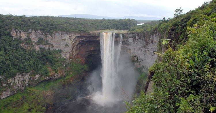
Kaieteur National Park is a National Park located in the Potaro-Siparuni Region of Guyana. The Park's boundaries and purpose are defined in the Kaieteur National Park Act, and was created to preserve the natural scenery (including Kaieteur Falls), and its fauna and flora. The Act is administered by the Kaieteur National Park Commission.
Boundaries
Original boundaries: Commencing at a point on the left bank of the Potaro River, 200 feet (61 m) below the Tukeit Rest House Compound, then along the trail to the Korume Creek, then up the Korume Creek to its source, then to and including Menzies landing on the left bank of the Potaro River, then across the Potaro River to its right bank, then inland for a 0.25 miles (400 m), then downwards and parallel to the right bank of the Potaro River to an unnamed tributary about 300 feet (91 m) below the foot of Tukeit Falls, then down the left bank of that tributary to the Potaro River, then to the point of origin.
In 1999 the Park's area was increased from 5 square miles (10 km2) to 242 square miles (630 km2) by a Presidential Order.