
Established 1997 Founded 1997 | Postcode(s) 4285 Postal code 4285 | |
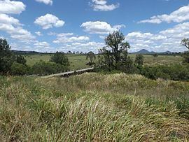 | ||
Kagaru is a rural locality split between City of Logan and Scenic Rim Region, Queensland, Australia.
Contents
Map of Kagaru QLD 4285, Australia
Geography
Kagaru's eastern border is marked by the Sydney–Brisbane rail corridor, the Logan River and Teviot Brook. There is very little development in the area.
History
In the 1930s, a railway station in the area was named Kagaru, an Aboriginal word for the blue-winged kookaburra. In 1996, the locality was formally bounded and took the name of the railway station.
Formerly in the Shire of Beaudesert, Kagaru became split between Logan City and Scenic Rim Region following the local government amalgamations in March 2008.
References
Kagaru, Queensland Wikipedia(Text) CC BY-SA