
Arabic كفرعانا Also spelled Kafar Ana Palestine grid 137/159 Local time Friday 5:53 PM Date of depopulation 25 April 1948 | Name meaning The village of Ana Area 17,553 dunams17.6 km² | |
 | ||
Weather 17°C, Wind N at 8 km/h, 62% Humidity | ||
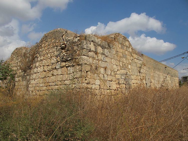
Tracing all that remains of destroyed village of kafr ana palestine
Kafr 'Ana' (Arabic: كفرئنا, also: Kafr Ana) was a Palestinian town located 11 kilometers (6.8 mi) east of Jaffa, built on the ancient site of Ono. In 1945, the town had an estimated population of 2,800 Arabs and 220 Jews. Captured by the pre-state Jewish forces of the Alexandroni Brigade prior to the outbreak of the 1948 Arab–Israeli War, it was depopulated.
Contents
- Tracing all that remains of destroyed village of kafr ana palestine
- Map of Kfar Ana Or Yehuda Israel
- History
- Byzantine period
- Ottoman period
- British Mandate period
- State of Israel
- Culture
- References
Map of Kfar Ana, Or Yehuda, Israel
History
The Canaanites and Israelites referred to the town as Ono (1 Chronicles 8:12), which name continued all throughout the First and Second Temple periods.
Byzantine period
Jewish classical writings mention the city as being formerly enclosed by a wall. Kafr 'Ana was known as Onous in the Byzantine era, and ceramics from that era have been found here.
Ottoman period
During early Ottoman rule in Palestine, the revenues of the village of Kafr 'Ana were in 1557 designated for the new waqf of Hasseki Sultan Imaret in Jerusalem, established by Hasseki Hurrem Sultan (Roxelana), the wife of Suleiman the Magnificent. In 1596, Kafr 'Ana appeared in the census located in the Nahiya of Ramla of the Liwa of Gazza. The population was 11 households, all Muslim. They paid a fixed tax-rate of 25% on agricultural products, including wheat, barley, summer crops, vineyards, fruit trees, sesame, goats and beehives; in addition to occasional revenues, a total of 26,800 Akçe. All of the revenue went to a waqf.
French explorer Victor Guérin visited the village in 1863 and noted that "near the village are two shallow basins hollowed in rock, not built up, which receive the winter rains. Several wells are here as well, which permit the gardens to be irrigated. By the side of one of these wells I observed trunks of columns which seemed ancient."
In 1882, the Palestine Exploration Fund's Survey of Western Palestine described Kafr 'Ana as a village built of adobe bricks and surrounded by palm trees.
British Mandate period
In the 1922 census of Palestine conducted by the British Mandate authorities, Kufr Ana had a population of 1,374 inhabitants, all Muslims. increasing the 1931 census to 1,824, still all Muslims, in a total of 449 houses.
The villagers grew crops and raised poultry and bees. In 1944/45 a total 2,214 dunums were used for growing citrus and bananas, while 11,022 dunums of village land was used for cereals. 597 dunums were irrigated or used for orchards, while 90 dunams were classified as built-up areas.
State of Israel
The village of Kafr 'Ana was depopulated in the weeks leading up to the 1948 Arab–Israeli War, during the Haganah's offensive Mivtza Hametz (Operation Hametz) 28–30 April 1948. This operation was held against a group of villages east of Jaffa, including Kafr 'Ana. According to the preparatory orders, the objective was for "opening the way [for Jewish forces] to Lydda". Though there was no explicit mention of the prospective treatment of the villagers, the order spoke of "cleansing the area" [tihur hashetah]. The final operational order stated: "Civilian inhabitants of places conquered would be permitted to leave after they are searched for weapons."
On 23 September 1948 General Avner named Kafr 'Ana as a suitable village for settlement for new Jewish immigrants ("olim") to Israel. Today, the modern Israeli city, Or Yehuda, is built upon the lands formerly belonging to Kafr 'Ana and Saqiya village and Kheiriya village. Or Yehuda was founded in 1950, on village land, south of the village site.
Culture
A woman's thob (loose fitting robe with sleeves), from Kafr Ana, from the 1930s, is in the Museum of International Folk Art (MOIFA) collection at Santa Fe, United States. The dress is of white commercial cotton and the embroidery is multicolored cotton, mainly in red and blue. The qabbeh (the square chest panel) is not a separate panel, but instead executed directly on the dress. The embroidery on the skirt and sleeves is also done directly on the dress. There is some machine embroidery, but most is by hand. The dress has an uncommon round neckline, which was an innovation and was only used here and in the village of Salama, near Jaffa.