
Length 21.4 km | Major cities Dwight | |
 | ||
Counties | ||
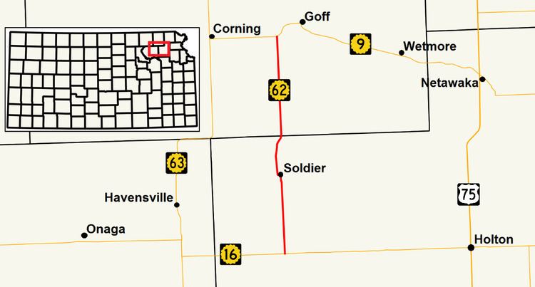
K-62 is a 13.3-mile-long (21.4 km) state highway in the U.S. state of Kansas. It is a north-south highway that serves towns in the northeastern part of the state. It parallels Soldier Creek for its entire length.
Contents
Route description
K-62 begins in rural Jackson County at K-16. It proceeds north through rolling hills filled with fields. Two miles (3.2 km) north of its terminus, it crosses Soldier Creek for the first of three times, and proceeds another two miles to cross the creek again, before entering Soldier, the only city the highway passes directly through. In the town, K-62 turns west on Jackson Street for a block, and turns north again on 2nd Street. After leaving the town to the north, the remaining two miles of highway before entering Nemaha County, wind through tree laden hills, where it crosses Soldier Creek for the final time. Upon entering Nemaha County, it resumes a due north course, and the terrain flattens considerably. K-62 continues through scenic rolling hills and fields before arriving at its northern terminus at K-9 two miles (3.2 km) southwest of Goff.
History
K-62 first appeared on the map in 1932. Prior to 1953, the highway exited Soldier to the west, rather than north, and intersected K-63 in Havensville.