
 | ||
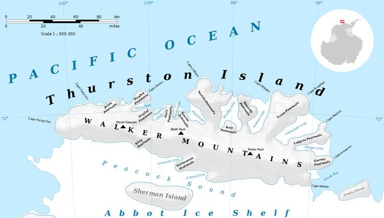
Jones Peninsula (71°55′S 100°50′W) is an ice-covered peninsula 5 nautical miles (9 km) west of Hughes Peninsula in northwest Thurston Island, Antarctica. It was named by the Advisory Committee on Antarctic Names after Ensign Robert H. Jones, navigator and second pilot of PBM Mariner aircraft in the Eastern Group of U.S. Navy Operation Highjump, which obtained aerial photographs of this peninsula and coastal areas adjacent to Thurston Island, 1946–47.
Maps
References
Jones Peninsula Wikipedia(Text) CC BY-SA