
Population 1,962 (?) Postcode(s) 0810 Postal code 0810 | Established 1970s Area 120 ha | |
 | ||
Location 11.6 km (7 mi) from Darwin | ||
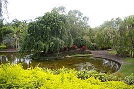
Jingili is a northern suburb of the city of Darwin, Northern Territory, Australia.
Contents
Map of Jingili NT 0810, Australia
History
Jingili was constructed in the early 1970s. Jingili is named after an Aboriginal tribe who inhabited the area around Elliott in the middle of the Territory.
The streets within Jingili are named after Flying Officers killed in the Darwin area during World War II and local people killed in action in France or Belgium during World War I.
Present day
Jingili is two kilometres from Casuarina Square. Jingili has a Primary School, a Pre-school and a Day-Care centre. The smaller shopping centre is well equipped for day-to-day shopping. One of Darwin's oldest cemeteries is located in this suburb not far from the Rapid Creek.
References
Jingili, Northern Territory Wikipedia(Text) CC BY-SA