
Founded 1906 Population 11,948 (2013) Unemployment rate 7.3% (Apr 2015) | Largest town Prentiss Area 1,059 km² County seat Prentiss Cities Prentiss, Bassfield | |
 | ||
Website www.jeffersondaviscountyms.com Rivers Bouie River, Hayden Creek, West Prong Silver Creek | ||
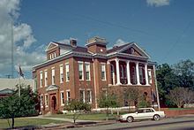
Jefferson Davis County is a county located in the U.S. state of Mississippi. As of the 2010 census, the population was 12,487. Its county seat is Prentiss. The county is named in honor of Mississippi Senator and Confederate President Jefferson Davis. The county was carved out of Covington and Lawrence counties in March 1906. Governor James K. Vardaman signed the bill creating the county on May 9, 1906.
Contents
- Map of Jefferson Davis County MS USA
- Geography
- Major highways
- Adjacent counties
- Demographics
- Towns
- Unincorporated communities
- Ghost town
- References
Map of Jefferson Davis County, MS, USA
Geography
According to the U.S. Census Bureau, the county has a total area of 409 square miles (1,060 km2), of which 408 square miles (1,060 km2) is land and 0.7 square miles (1.8 km2) (0.2%) is water.
Major highways
Adjacent counties
Demographics
As of the 2010 United States Census, there were 12,487 people residing in the county. 59.9% were Black or African American, 38.7% White, 0.3% Native American, 0.1% Asian, 0.3% of some other race and 0.7% of two or more races. 0.8% were Hispanic or Latino (of any race).
As of the census of 2000, there were 13,962 people, 5,177 households, and 3,768 families residing in the county. The population density was 34 people per square mile (13/km²). There were 5,891 housing units at an average density of 14 per square mile (6/km²). The racial makeup of the county was 41.66% White, 57.38% Black or African American, 0.14% Native American, 0.18% Asian, 0.01% Pacific Islander, 0.08% from other races, and 0.57% from two or more races. 0.77% of the population were Hispanic or Latino of any race.
There were 5,177 households out of which 32.9% had children under the age of 18 living with them, 45.7% were married couples living together, 21.6% had a female householder with no husband present, and 27.2% were non-families. 25.0% of all households were made up of individuals and 11.9% had someone living alone who was 65 years of age or older. The average household size was 2.68 and the average family size was 3.20.
In the county, the population was spread out with 28.4% under the age of 18, 9.9% from 18 to 24, 25.4% from 25 to 44, 22.5% from 45 to 64, and 13.8% who were 65 years of age or older. The median age was 35 years. For every 100 females there were 89.9 males. For every 100 females age 18 and over, there were 84.7 males.
The median income for a household in the county was $21,834, and the median income for a family was $27,594. Males had a median income of $23,942 versus $16,510 for females. The per capita income for the county was $11,974. About 23.2% of families and 28.2% of the population were below the poverty line, including 38.7% of those under age 18 and 24.5% of those age 65 or over.