
Elevation 452 m Area code 07420 Founder Mughal Empire | Population 16,687 (2011) Local time Friday 12:32 PM | |
 | ||
Weather 17°C, Wind SW at 13 km/h, 59% Humidity Points of interest Nimach Gate, Khor Gate, Bawal Gate, Rampura Gate | ||
{{Infobox settlement | name = Jawad | native_name = जावद
Jawad is a Tehsil and a Nagar Panchayat in Neemuch district in the Indian state of Madhya Pradesh.
Contents
- Map of Jawad Madhya Pradesh
- History
- Tourism
- Demographics
- Economy
- Development
- Notable Personalities
- Industries
- Towns and Villages in Jawad Tehsil
- References
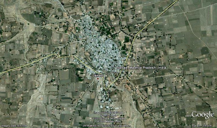
Map of Jawad, Madhya Pradesh
History
In Arabic, JAWAD means big hearted and sakhi. Jawad was a part of the Udaipur princely state and was later occupied by the Marathas. Jawad has many famous and big temples. The town was surrounded by shahr kot (fort) with five major gates and 56 Bastille, the ruins of these can still be seen. In 1901 more than 36 banker families were engaged in money lending business and at that time the town was an important business center of Maratha Kingdom (Gwalior State). Earlier it had the largest agriculture area under opium production; nowadays very limited area falls under opium production.
Tourism
Tourist attraction near Jawad include Sukhanand ji - a mini waterfall and a temple is present at Sukhanandji - ideal for picnics. Khor Village which is 6 km from Jawad has many more attractions including - The Nav Toran Temple. It is rumoured that one underground tunnel directly connects this temple to the Chittorgarh Fort of Maharana Pratap. The major industries include - Vikram Cement Plant, which is one of the major plants of the Aditya Birala Group, is also located in Khor Village and this is a very big job hub for the people of Jawad Tehsil. There is a tomb of Miya Saheb Mamaji Saheb (Shk. Mohammad) who was a great social worker of Jawad. His Urs is celebrated every year on 29th Jumadil -Ul- Ula ( Month of Hijri Cal )
Temples - In Jawad there are a lot of temples like "Lalji Dwara Mandir",Laxminath, Bhuteshwar, Batkeshwar, Sai Mandir etc. All the festivals are celebrated in Jawad with fervour and unity.
Demographics
As of 2001 India census, Jawad had a population of 16,143. Males constitute 51% of the population and females 49%. Jawad has an average literacy rate of 70%, higher than the national average of 59.5%: male literacy is 80%, and female literacy is 59%. In Jawad, 14% of the population is under 6 years of age. Now as of Census of India 2011, the population of Jawad is 16,687 in total and after merging nearby villages that are now come into Jawad will become 19,000 apx.
Economy
Agriculture is the occupation of Most of the people. The region is a part of one of the important producers of opium in the world.
Important Crops:-
Development
The old Jawad consists of narrow byelanes and important markets. The bus stand is situated in the heart of the town with buses to Nimach, Mandsaur, Indore, Ratlam and nearby cities of Rajasthan like Chittaurgarh, Bhilwara and even Jaipur. The new Jawad consists of huge bungalows and mansions on the Nimach road. There are huge farmhouses adjoining farms on the Nimach road which is being widened to a 4 lane road within Jawad tehsil boundary. Nimach Road is the new hub of developmental activities in Jawad with State Bank of India having a branch there. The Agrasen Manglik Bhavan is located on Nimach Road which is a major community hall for the residents of Jawad. The Jawad police station and the guest house are also situated on Nimach road.
Notable Personalities
- Satyanarayan Jatiya
- Virendra Kumar Saklecha
Industries
- Lamha Industry
- SMB Shri Ram Engineering
- Goyal Oil Mill
Towns and Villages in Jawad Tehsil
- Jawad Nagar Panchayat
- Diken Nagar Panchayat
- Athana Nagar Panchayat
- Nayagaon Nagar Panchayat
- Khor Census Town
- Achlawada
- Akhepur
- Akli
- Amarpura
- Amba [Ratangarh]
- Amlibhat
- Arnya [Mamadeo]
- Asan Dariyanath
- Ata
- Bangred
- Barada
- Barkheda Chauhan
- Barkheda Jat
- Barkheda Kamaliya
- Barkheda Mina
- Basedibhati
- Bawaljuni
- Bawalnai
- Bhagwanpura [Gudanathur]
- Bhojpura
- Bolkheda
- Borkhedi
- Budhsinghpura
- Chadol [Athana]
- Chirmikheda
- Dadoli
- Damodarpura
- Depalpura
- Dhaba
- Dhabi
- Dhalopa
- Dhamaniya
- Dhaneriya
- Dhani
- Gadola
- Gotha
- Gothada
- Gujarkhedi Sankla
- Gujarkhedi Talab
- Guthlai
- Hanmantiya
- Haripura [Ratangarh]
- Jagepur Mina
- Jagepur [Hada]
- Janakpur
- Jetpura
- Jhirmir
- Jivapura
- Kalepur
- Kamawas
- Kandka
- Kashya
- Kelukheda
- Kenpuriya
- Kesharpura Kalan
- Kesharpura Khurd
- Khatikheda
- Kheda Modi
- Kheda Rathor
- Kherkheda
- Khurdkhedi
- Kirpurakalan
- Kirpurakhurd
- Kundala
- Kundala Ratangarh
- Lapiya
- Lasur
- Lodh
- Madawada
- Mahendri
- Maheshpura
- Malgarh
- Manda
- Meghpura
- Melankheda
- Mendki
- Modi
- Morka
- Morwan
- Nagda
- Nagthun
- Nanpuriya
- Niliya
- Padla
- Paldakheda
- Panoli
- Parwani
- Pipalya Premji
- Ranipura
- Ranpur
- Ruppura
- Ruppura Morwan
- Sakhatpuriya
- Samel
- Saroda
- Sarwaniya Maharaj
- Sarwaniya Masani
- Segewa
- Shyampura
- Sukhanand [Naya]
- Suntholi
- Suwa Kheda
- Tarapur
- Tumba
- Ummedpura
- Upreda