
Country United States County Suffolk Time zone Eastern (EST) (UTC-5) Elevation 4.9 m Population 1,710 (2010) | State New York Town Riverhead FIPS code 36-38253 Zip code 11947 Area code 631 | |
 | ||
Area 11.65 km² (11.65 km² Land / 10 ha Water) | ||
Jamesport is a census-designated place (CDP) that roughly corresponds to the hamlet by the same name in the Town of Riverhead in Suffolk County, New York, United States. The CDP's population was 1,710 at the 2010 census.
Contents
Map of Jamesport, NY, USA
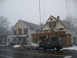
Jamesport is known for its quaint downtown area including antique shops and a handful of fine restaurants. The population of the hamlet grows considerably during the summer months due to the influx of day-tourists and vacationers taking advantage of the Great Peconic Bay beaches located on the south side of the hamlet. During the late summer/fall months, the hamlet is busy once again, due to "pumpkin pickers", "wine tasters", and other tourists taking in the beautiful fall scenery Jamesport has to offer. Jamesport is home to many farms including sod, pumpkin, flower, potato and wineries. Jamesport State Park is located north of Jamesport in the adjacent hamlet of Northville. A 2010 park master plan called for it to be renamed the "Hallock State Park Preserve".
Geography
According to the United States Census Bureau, the CDP has a total area of 4.5 square miles (11.7 km2), of which 4.5 square miles (11.6 km2) is land and 0.039 square miles (0.1 km2), or 0.60%, is water.
History
The hamlet now called Jamesport was first settled in the 1690s and originally was called Aquebogue. It became Lower Aquebogue when another hamlet was established to the west called Upper Aquebogue. The Jamesport Meeting House, built in 1731, is the oldest operating church building in Suffolk County.
The name "Jamesport" refers to James Tuthill, who settled the area south of Lower Aquebogue on the Peconic Bay with his family in 1833. Over time Lower Aquebogue came to be called Jamesport, while the community 1 mile (2 km) to the south previously called Jamesport came to be called South Jamesport (and is included in the present-day Jamesport CDP). Upper Aquebogue became just Aquebogue.
James Tuthill's attempt to establish a commercial whaling and shipping wharf on the Peconic Bay in what is now South Jamesport was a failure. The depth of water at low tide was too shallow to accommodate ships. However, soon after this the Long Island Rail Road established service to Jamesport from New York City, and Jamesport became a popular resort and fishing community with several large bayfront hotels, including the Miamogue Hotel and the Great Peconic Bay House which operated until 1952. Jamesport was a center for the scallop and bunker (menhaden) fisheries. From the 1830s to about 1950 Jamesport was the site of a Camp Meeting Grove operated by the Methodist Episcopal Church and, after 1904, an Epworth League Fresh Air Camp.
During the 1960s, the Long Island Lighting Company (LILCO) designated land on the North Shore of Long Island for use as a possible second nuclear power station, in addition to its Shoreham plant, already under construction. However, when LILCO ran into opposition to Shoreham in the 1970s and 1980s, the Jamesport plan was scrapped.
Demographics of the CDP
As of the census of 2000, there were 1,527 people, 605 households, and 434 families residing in the CDP. The population density was 345.1 per square mile (133.3/km²). There were 959 housing units at an average density of 216.9/sq mi (83.8/km²). The racial makeup of the CDP was 98.03% White, 0.59% African American, 0.52% Asian, 0.13% Pacific Islander, 0.26% from other races, and 0.46% from two or more races. Hispanic or Latino of any race were 6.36% of the population.
There were 605 households out of which 26.1% had children under the age of 18 living with them, 60.7% were married couples living together, 8.8% had a female householder with no husband present, and 28.1% were non-families. 24.0% of all households were made up of individuals and 11.7% had someone living alone who was 65 years of age or older. The average household size was 2.41 and the average family size was 2.88.
In the CDP, the population was spread out with 20.6% under the age of 18, 5.0% from 18 to 24, 26.8% from 25 to 44, 27.7% from 45 to 64, and 19.9% who were 65 years of age or older. The median age was 43 years. For every 100 females there were 102.7 males. For every 100 females age 18 and over, there were 97.9 males.
The median income for a household in the CDP was $67,891, and the median income for a family was $80,748. Males had a median income of $41,917 versus $46,313 for females. The per capita income for the CDP was $28,614. About 4.9% of families and 7.9% of the population were below the poverty line, including 2.5% of those under age 18 and 7.1% of those age 65 or over.