Country United States County Alcorn GNIS feature ID 671757 Local time Friday 5:26 PM | State Mississippi Time zone Central (CST) (UTC-6) Elevation 171 m | |
 | ||
Weather 21°C, Wind S at 19 km/h, 59% Humidity | ||
Jacinto, founded in 1836, was named for the Battle of San Jacinto in the Texas Revolution. Jacinto was located in the geographic center of the original Tishomingo County, Mississippi. Within ten years of its founding, Jacinto became a flourishing town with stores, hotels, schools, churches, and taverns, serving as the center of government and commerce for the county.
Map of Jacinto, MS 38865, USA
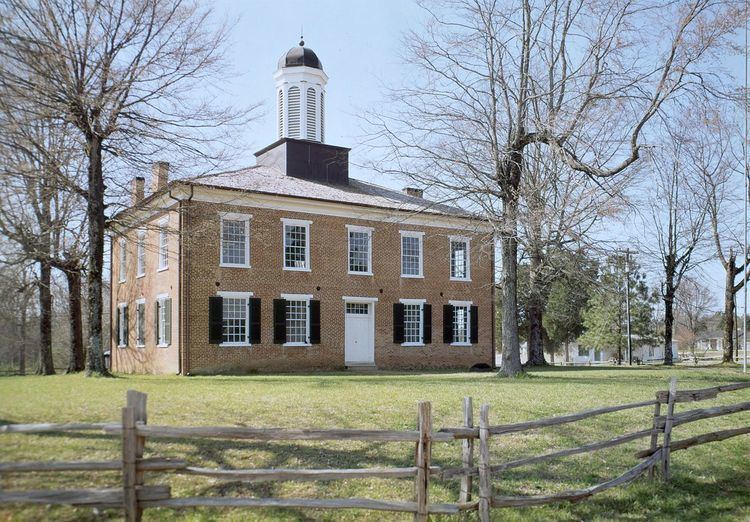
Jacinto is the site of a courthouse built in 1854 in the Federal style as the county courthouse for the original Tishomingo County. The courthouse has been refurbished and is listed in the National Register of Historic Places. It is open to visitors.
In 1869, Tishomingo was divided into three counties: Tishomingo, Alcorn, and Prentiss. Corinth became the county seat of newly established Alcorn County, Iuka of the reduced Tishomingo County, and Booneville of the new county of Prentiss. When the county seat was moved from Jacinto in 1870, the town's importance declined, and town residents and businesses began moving away.
Jacinto appears on the Glens U.S. Geological Survey Map.
