District Kitatsugaru Area 41.88 km² Local time Friday 9:59 AM | Population 14,136 (Nov 2015) | |
 | ||
- Flower Platycodon grandiflorus Weather 3°C, Wind NW at 11 km/h, 56% Humidity | ||
Itayanagi (板柳町, Itayanagi-machi) is a town located in Kitatsugaru District of northeastern Aomori Prefecture in the northern Tōhoku region of Japan. As of November 2015, the town had an estimated population of 14,136 and a population density of 338 persons per km². Its total area was 41.88 square kilometres (16.17 sq mi).
Contents
- Map of Itayanagi Kitatsugaru District Aomori Prefecture Japan
- Geography
- Neighbouring municipalities
- History
- Economy
- Education
- Railway
- Highway
- International relations
- Noted people from Itayanagi
- References
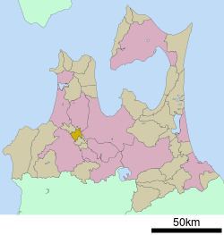
Map of Itayanagi, Kitatsugaru District, Aomori Prefecture, Japan
Geography
Itayanagi is located at the base of Tsugaru Peninsula. The town has a cold maritime climate characterized by cool short summers and long cold winters with heavy snowfall.
Neighbouring municipalities
History
The area around Itayanagi was controlled by the Nambu clan of Morioka Domain during the Edo period, and was the location of a daikansho. After the Meiji Restoration, on March 27, 1895 it was formed into a village. It was elevated to town status on April 1, 1920. On March 10, 1955, it annexed the neighboring villages of Hataoka, Koami, and Arakawa.
Economy
The economy of Itayanagi is heavily dependent on horticulture, especially for apples, with rice as a secondary crop.
Education
Itayanagi has four elementary schools, one middle school and one high school.
