
Population 829 (2011 census) Civil parish Islip Local time Thursday 7:01 AM UK parliament constituency Corby | OS grid reference SP9878 Sovereign state United Kingdom Dialling code 01832 | |
 | ||
Weather 6°C, Wind SW at 13 km/h, 98% Humidity | ||
Islip /ˈaɪzlɪp/ is a village and civil parish in East Northamptonshire, England. The village is just west of Thrapston and 7 miles (11 km) east of Kettering. The parish is bounded to the east by the River Nene and to the north by Harpurs Brook, a tributary of the Nene. The 2011 Census recorded the parish's population as 829 people.
Contents
Map of Islip, Kettering, UK
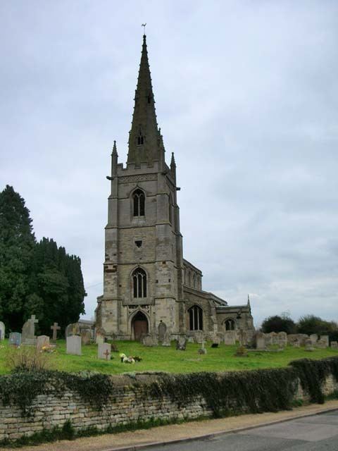
Parish church
Islip had a parish church by the early 13th century but the present Perpendicular Gothic Church of England parish church of Saint Nicholas was built early in the 15th century. St. Nicholas' shares a benefice with the parishes of Thrapston and Denford.
Social and economic history
The manor of Islip was held by Geoffrey de Mowbray, Bishop of Coutances in 1086. When he lost his English estates a few years later due to rebellion, the Crown granted part of the manor to Westminster Abbey and, in the early 12th century, part to Aubrey de Vere II, a royal chamberlain. Aubrey's son Robert held in Islip, Drayton, and Addington, Northamptonshire.
Matthias Nicoll moved to New York from Islip in 1664. The town of Islip in Suffolk County, New York is named after the Northamptonshire village.
Amenities
The village has two public houses: The Rose and Crown and The Woolpack Inn. It has also a working men's club, a hairdresser and a beauty salon.
Islip also has a football team, Islip United FC.