
Gaelic name Eilean Ruisteil Area rank 103 Area 225 ha | OS grid reference NB971112 Highest elevation 71 m Council area Highland | |
 | ||
Island groups British Isles, Inner Hebrides | ||
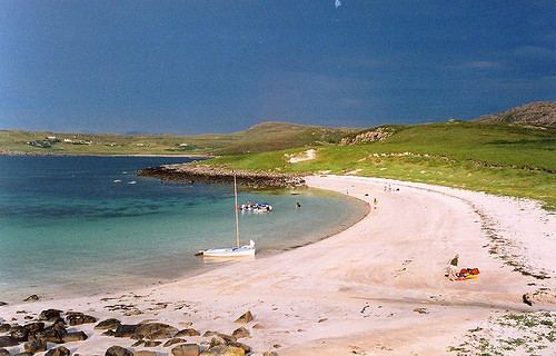
Isle Ristol, the innermost of the Summer Isles in Scotland, is a Scottish Wildlife Trust Reserve.
Map of Isle Ristol, United Kingdom
Lying roughly 12 miles (19 km) north of Ullapool in Wester Ross, it is a tidal island, in Loch an Alltain Duibh, that is separated by a narrow channel from Old Dorney Bay. Access is by boat from Old Dornie.
Over fifty higher species have been identified amongst the flora on the Isle Ristol machair, amongst which are moonwort and adder's tongue.
Isle Ristol was a site of a British Fishery Society station in the late 18th century.
References
Isle Ristol Wikipedia(Text) CC BY-SA