
Time zone TJT (UTC+5) Area code(s) +992 3553 Founded 27 October 1932 | Postal code 736500 Area 3,656 km² Population 28,400 (2008) | |
 | ||
Weather -4°C, Wind S at 6 km/h, 66% Humidity Province Gorno-Badakhshan Autonomous Region | ||
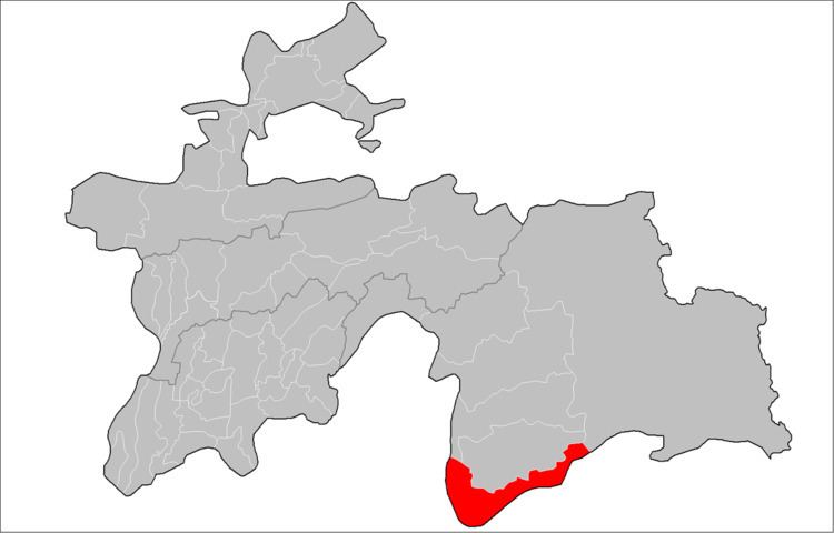
Ishkoshim District or Nohiya-i Ishkoshim (Tajik: Ноҳияи Ишкошим/Persian: ناحیه اشکاشم) is a district in east Tajikistan, in the extreme south-west of the Gorno-Badakhshan Autonomous Region (GBAO). It borders Afghanistan along the Panj River to the south and to the west. The population of Ishkoshim district is 28,400 (1 January 2008 estimate).
The district is roughly V-shaped and lies northeast of the Panj River where its course turns from west to north. It is bordered on the south and west Afghanistan across the Panj River and the lower Pamir River and on the north by Roshtqal'a District. There are short borders with Shughnon District to the north and Murghab District to the east. The Shakhdara Range is along the northern border with Roshtqal'a District and the north-south Ishkoshim Range is along the district's eastern border.
The district capital is Ishkoshim, a town at the bend of the Panj, opposite the Ishkashim district with a similar name. There is an ancient balas ruby (technically spinel) mine at Kuh-i-Lal. Ishkoshim District is a particularly attractive destination in Gorno-Badakhshan for its archeological sites and spectacular scenery.