
Country Spain Comarca Cuadrilla de Añana Elevation 500 m (1,600 ft) Population 3,108 (2014) Province Álava | Autonomous community País Vasco Founded In 1976 Area 53.25 km² Local time Wednesday 8:11 PM | |
 | ||
Demonym(s) Iruñaokar, iruñar (in Basque) Weather 12°C, Wind N at 8 km/h, 81% Humidity | ||
Iruña de Oca (Basque: Iruña Oka) is a municipality located in the province of Álava, in the Basque Country, northern Spain. Is compounded by five towns called "concejos" which names are:
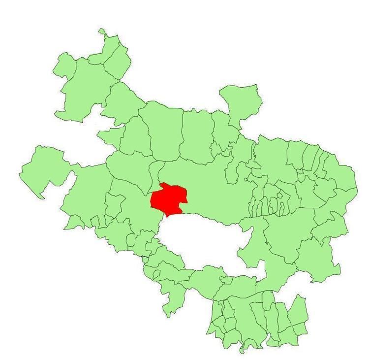
Map of Iru%C3%B1a de Oca%2FIru%C3%B1a Oka, %C3%81lava, Spain
It was formed in 1976 by the merger of the municipalities of Iruña (Trespuentes and Víllodas) and Nanclares de la Oca (Montevite, Ollávarre and Nanclares).
Iruña de Oca is the most populated municipality of the Cuadrilla de Añana. More than the 35% of the people of Añana live there.
It is located in the central part of the Álava province, just 14 km far from Vitoria, the capital city of the Basque Country.
References
Iruña de Oca/Iruña Oka Wikipedia(Text) CC BY-SA