
Area less than one acre Architectural style Rustic Opened 1933 | Built 1933 (1933) NRHP Reference # 93001091 Added to NRHP 20 October 1993 | |
 | ||
MPS Facilities Constructed by the CCC in Arkansas MPS | ||
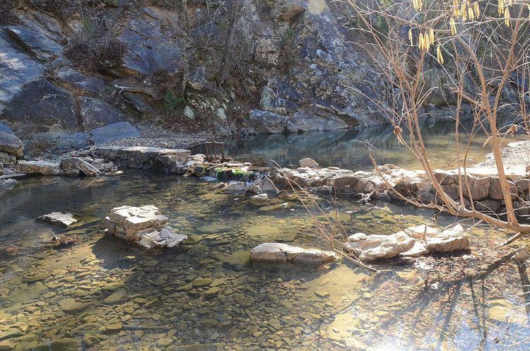
The Iron Springs Recreation Area is a roadside picnic area on Arkansas Highway 7, north of Jessieville in the Ouachita National Forest. The area has three shelters for picnicking, vault toilets, and an accessible trail for viewing the springs in the area. The facilities were largely built by the Civilian Conservation Corps (CCC) in the 1930s, with two shelters and the nearby dam listed on the National Register of Historic Places.
Setting and history
The Iron Springs picnic area is set on the west side of Arkansas Highway 7, about 4.5 miles (7.2 km) north of Jessieville, between the road and the Middle Fork Saline River. The river is impounded by a low fieldstone dam, built by the CCC in 1933, which features alternating chutes and steps, and impounds enough water to form a modest swimming hole.
The picnic area includes three covered shelters, two of which were built by the CCC in 1933. The first is about 24 by 14 feet (7.3 m × 4.3 m), built with open log construction and topped by a gable roof. The north and south sides of the shelter have log balustrades, while the other two sides are open; a picnic table is set under the shelter. The second is more square in shape, with a pyramidal roof, but also has balustrades on the north and south sides.