
Existed: 1987 – present Constructed 1987 | Length 12.3 km | |
 | ||
County Davidson County, Tennessee | ||
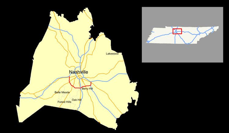
Interstate 440 (abbreviated I-440 and known locally as the Four-Forty Parkway) in Tennessee is a 7.64-mile-long (12.30 km) loop which connects I-24, I-40, and I-65, while bypassing downtown Nashville to the south.
Contents
Map of I-440, Nashville, TN, USA
Route description
West of downtown Nashville, I-440 heads south from I-40 and goes on to meet U.S. Route 70S before turning due east. I-440 then intersects U.S. Route 431 and later, I-65 south of downtown Nashville. I-440 then turns northeast and meets with U.S. Route 31A/U.S. Route 41A before terminating at I–24, west of the Nashville International Airport.
History
The section between I-24 and I-65 was completed in 1986, and the section between I-65 and I-40 was completed in 1987. It was the most expensive road, per mile, built in Tennessee at the time. The interstate is one of the most congested rush-hour highways in the state, with three lanes in each direction, a speed limit set at 55 mph, and an AADT of 106,219.
Exit list
The entire route is in Nashville, Davidson County.