
Country United States Area code(s) 539/918 Elevation 183 m Population 1,817 (2013) | Time zone Central (CST) (UTC-6) FIPS code 40-37100 Zip code 74036 Local time Monday 5:17 AM | |
 | ||
Weather 6°C, Wind S at 3 km/h, 92% Humidity Area 17.09 km² (16.83 km² Land / 26 ha Water) | ||
Inola is a town in Rogers County, Oklahoma, United States. It is included in the Tulsa Metropolitan Statistical Area (TMSA). The population was 1,788 at the 2010 census, a 12.5 percent increase from 1,589 at the 2000 census. Inola is a Cherokee word meaning "Black Fox." The town styles itself as "The Hay Capital of the World." It is now considered a bedroom community for Tulsa.
Contents
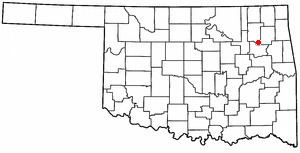
Map of Inola, OK, USA
History
In 1889, the Kansas and Arkansas Valley Railway (later acquired by the Missouri Pacific Railway) built a line from Wagoner, Oklahoma through the Foyil area on to the Kansas state line. The area was then just inside the northeastern corner of the Creek Nation in Indian Territory. A post office was established in March 1890 with the name Foyil. It was closed in September 1890, but reopened in April 1891. By 1901, the population was estimated at 100 people. The Dawes Commission had the town platted in 1902, before the Creek allotment.
Strip mines began producing coal nearby before statehood in 1907, causing a small boom in population. Inola's population was 405 in 1920. As the coal industry began to decline, so did the town's population. The 1930 census reported only 399 residents. The decline continued through the post World War II era, reaching 294 in 1950. A turnaround began in the 1950s as residents began commuting to Tulsa. Inola's population grew to 584 in 1960 and 984 in 1970. Growth continued despite the Black Fox Nuclear Power Plant (discussed below), The 1980 census showed 1,550 residents, increasing to 1,589 in 2000 and 1,788 in 2010.
Geography
Inola is located at 36°7′59″N 95°31′26″W (36.133182, -95.523938). According to the United States Census Bureau, the town has a total area of 6.6 square miles (17 km2), of which, 6.5 square miles (17 km2) of it is land and 0.1 square miles (0.26 km2) of it (0.91%) is water.
Black Fox Power Plant
The Black Fox Nuclear Power Plant was a nuclear power plant proposed by the Public Service Company of Oklahoma (PSO) in May 1973. The facility was to be built approximately 3 miles (4.8 km) outside of Inola, Oklahoma, and encompass the use of two General Electric (GE) Boiling Water Reactors. PSO pointed out to the citizens of Inola that there would be great economic growth and better schools. The residents, as well as outsiders, were convinced it would be a dangerous to locate such a facility in their backyards. After nine years of court battles, the decision was abandoned in 1982 and no complex was built.