
Population 463 (2011) Postal code 4285 | Postcode(s) 4285 | |
 | ||
Innisplain is a rural locality in the Scenic Rim Region, Queensland, Australia. In the 2011 census, Innisplain and surrounding localities had a population of 463 people.
Contents
Map of Innisplain QLD 4285, Australia
Geography
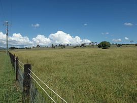
Part of the Logan River and the Mount Lindesay Highway marks the western boundary. The area is hilly with some land used for agriculture. The Sydney–Brisbane rail corridor passes through the area.
History
A railway station on the Beaudesert Shire Tramway was located at Innisplain, opening in 1903. A state school operated from 1921 to 1962.
References
Innisplain, Queensland Wikipedia(Text) CC BY-SA