Population 416 (2006 census) State electorate(s) Cook Local time Monday 4:59 PM | Postcode(s) 4876 Postal code 4876 Federal division Division of Leichhardt | |
 | ||
LGA(s) Injinoo Shire Council, Torres Shire Council Weather 28°C, Wind W at 6 km/h, 77% Humidity | ||
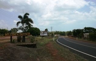
Injinoo Aboriginal Community was an Aboriginal settlement and later Anglican mission established on Cape York by a community led by a Wuthathi man, Allelic Whitesand. At the 2006 census, Injinoo had a population of 416.
Map of Injinoo QLD 4876, Australia
Although self-sufficient, through fishing and gardening, the Community made requests to the then Church of England to establish a mission and school. Queensland government officials allowed the community to function through an elected Council.
After the Second World War, which saw a considerable military presence in the area, many Torres Strait Islanders began moving into Injinoo. Settlements were subsequently built at Bamaga, New Mapoon and Umagico to relocate evicted people from this and other areas of the Cape. In 1948 a reserve was created, with control of the area having been taken over by the Queensland Department of Native Affairs.
