
Population 11 (2011) | County Donegal Area 120 ha | |
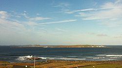 | ||
Inishbofin (Inis Bó Finne in Irish, meaning Island of the White Cow) is an island off the coast of Machaire Uí Rabhartaigh (Magheraroarty), County Donegal, Ireland.
Contents
Map of Inishbofin, Co. Donegal, Ireland
Geography
It is a 120-hectare (300 acre) land mass long known as a fishing and farming village, a place where generations of inhabitants have spoken Irish. The current population numbers about 36. There are no pubs or shops on the island. There is a boat service to and from it but no regular ferry.
It is the largest of a small group of islands; the others, Inis Dúiche and Inis Beag, lie to the north and are uninhabited.
Demographics
Inishbofin's population dropped in 110 years from 150 (1901) to 11 (2011).
The table reports data taken from Discover the Islands of Ireland (Alex Ritsema, Collins Press, 1999) and the Census of Ireland. Census data in Ireland before 1841 were not complete and/or reliable.