
Local time Monday 4:15 AM | Area 61.98 km² Population 2,500 (2008) | |
 | ||
Time zone Japan Standard Time (UTC+9) Weather 3°C, Wind S at 3 km/h, 72% Humidity | ||
Ine (伊根町, Ine-chō) is a town located in Yosa District, Kyoto Prefecture, Japan. The Tango Peninsula was a trade route from Eurasian Continent to Kyoto.
Contents
- Map of Ine Yosa District Kyoto Prefecture Japan
- History
- Geography
- Politics and government
- Industrial population
- Fishery
- Bus
- Ports
- Tourism
- References
Map of Ine, Yosa District, Kyoto Prefecture, Japan
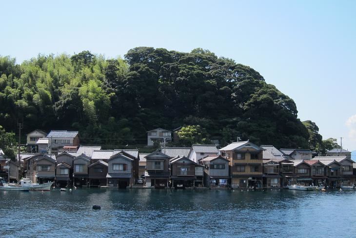
It is famous for wooden fishing houses called funaya, selected as Groups of Traditional Buildings. Tsutsukawa district and Honjo-Hama district have been handed down Urashima Tarō legend.
As of 2008, the town has an estimated population of 2,500. The total area is 61.98 km².
History
Ine was founded on November 3, 1954 by the merger of four villages.
Geography
Located on the coast of the Sea of Japan on the northeast side of the Tango Peninsula in the northwestern corner of the prefecture.
Politics and government
Ine is governed by mayor Yoshimoto Hideki, an independent. The city assembly has 10 members.
Industrial population
Fishery
An total annual a catch is 3,190 tons, account for 25 percent of all a catch in Kyoto Prefecture.