
Basin size 450 km (170 sq mi) Basin area 450 km² | River mouth Indre62 m (203 ft) Length 69 km | |
 | ||
Main source Villegouin180 m (590 ft) Discharge Average rate:2.29 m/s (81 cu ft/s) | ||
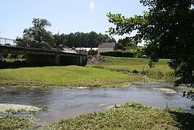
The Indrois is a 68.8-kilometre (42.8 mi) long river in the Indre and Indre-et-Loire départements, central France. Its source is at Villegouin. It flows generally northwest. It is a right tributary of the Indre into which it flows at Azay-sur-Indre.
Départements and communes along its course
This list is ordered from source to mouth:
References
Indrois Wikipedia(Text) CC BY-SA