
- elevation 2,315 ft (706 m) - elevation 1,132 ft (345 m) Basin area 111.4 km² | - location east of Baileysville Length 32 km Mouth Guyandotte River | |
 | ||
- location southeastern Wyoming County | ||
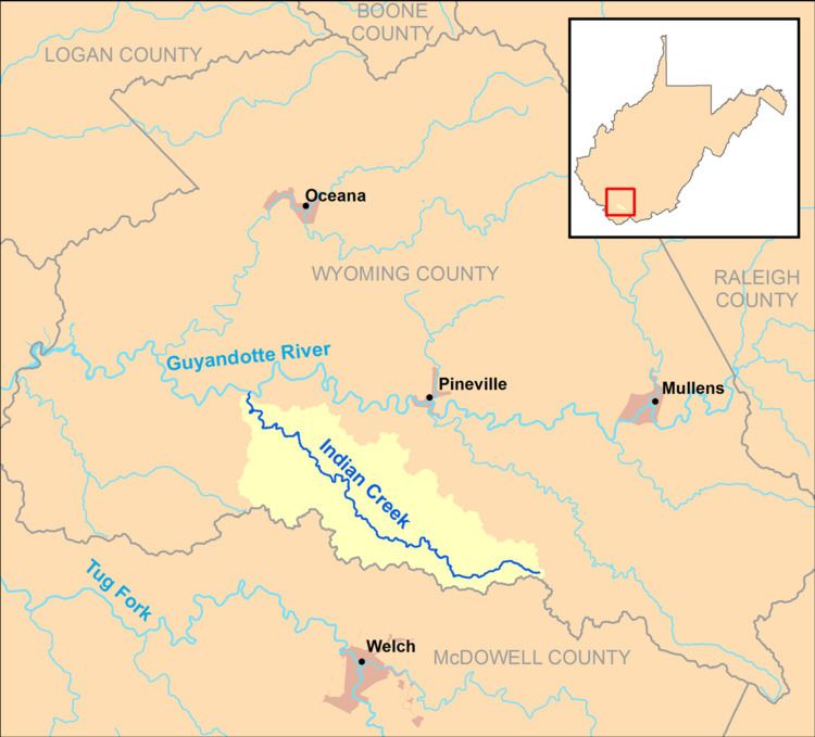
Indian Creek is a tributary of the Guyandotte River, 19.7 miles (31.7 km) long, in southern West Virginia in the United States. Via the Guyandotte and Ohio rivers, it is part of the watershed of the Mississippi River, draining an area of 43 square miles (110 km2) in a rural area on the unglaciated portion of the Allegheny Plateau.
Indian Creek's entire course and drainage area are in southern Wyoming County. It rises in southeastern Wyoming County, approximately 5 miles (8.0 km) south of New Richmond, and flows generally northwestward, through the unincorporated communities of Wolf Pen, Fanny, and Fanrock. It flows into the Guyandotte River from the south, approximately 0.3 miles (0.48 km) east of Baileysville. A section of the creek's middle course is paralleled by West Virginia Route 16.
According to the West Virginia Department of Environmental Protection, approximately 97.7% of the Indian Creek watershed is forested, mostly deciduous.