
Country United States FIPS code 48-35828 Elevation 729 m Zip code 79743 Area code 432 | Time zone Central (CST) (UTC-6) GNIS feature ID 1359897 Area 10.9 km² Population 278 (2010) | |
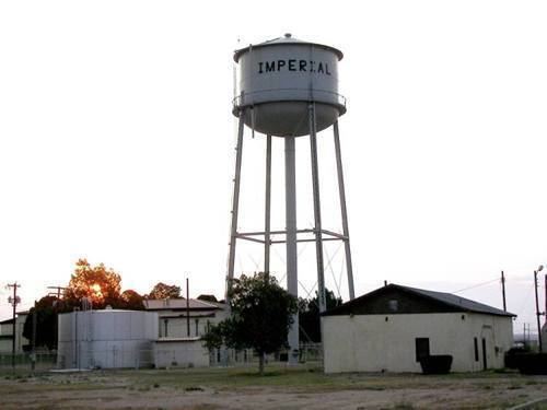 | ||
Imperial is a census-designated place (CDP) in Pecos County, Texas, United States. The population was 278 at the 2010 census.
Contents
Map of Imperial, TX 79743, USA
Geography
Imperial is located at 31°16′19″N 102°41′45″W (31.271968, -102.695799). It is situated at the intersection of Farm Roads 11 and 1053, four miles south of the Pecos River and approximately 30 miles northeast of Fort Stockton in northern Pecos County.
According to the United States Census Bureau, the CDP has a total area of 4.2 square miles (11 km2), all of it land.
History
The community was settled in the early 1900s. The site was originally known as Redlands from 1908 to around 1910, when it was renamed after California's Imperial Valley. A post office and school were opened in 1910 and a townsite was laid out on land owned by Benjamin E. Bush one year later. Water from the Pecos River was diverted and a small dam was built west of the community. An irrigation canal was constructed through Imperial in an attempt to attract new residents, but the area's water had a high salt content, which made farming unproductive. The population was approximately 25 in the mid-1920s, but had increased tenfold by 1949. Imperial's population approached 1,000 by the late 1960s with twenty-six businesses operating in the community. The number of inhabitants continued to decline during the latter half of the twentieth century.
Demographics
As of the census of 2000, there were 428 people, 156 households, and 126 families residing in the CDP. The population density was 101.1 people per square mile (39.1/km²). There were 245 housing units at an average density of 57.9/sq mi (22.4/km²). The racial makeup of the CDP was 79.21% White, 0.23% African American, 0.93% Native American, 1.40% Asian, 14.02% from other races, and 4.21% from two or more races. Hispanic or Latino of any race were 36.92% of the population.
There were 156 households out of which 34.6% had children under the age of 18 living with them, 68.6% were married couples living together, 7.1% had a female householder with no husband present, and 18.6% were non-families. 18.6% of all households were made up of individuals and 8.3% had someone living alone who was 65 years of age or older. The average household size was 2.74 and the average family size was 3.09.
In the CDP, the population was spread out with 28.7% under the age of 18, 7.9% from 18 to 24, 22.0% from 25 to 44, 27.1% from 45 to 64, and 14.3% who were 65 years of age or older. The median age was 40 years. For every 100 females there were 102.8 males. For every 100 females age 18 and over, there were 117.9 males.
The median income for a household in the CDP was $24,375, and the median income for a family was $28,333. Males had a median income of $35,938 versus $20,938 for females. The per capita income for the CDP was $16,464. About 18.5% of families and 24.4% of the population were below the poverty line, including 30.6% of those under age 18 and 6.5% of those age 65 or over.
Education
Imperial is served by the Buena Vista Independent School District and home to the Buena Vista High School Longhorns.