
Peak Mount Foster Width 6.8 km (4.2 mi) Elevation 2,105 m Country Antarctica | Length 30 km (19 mi) State/Province South Shetland Islands Highest point Mount Foster Mountains Mount Foster | |
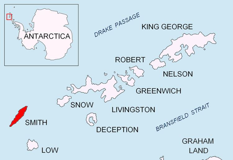 | ||
Imeon Range (Bulgarian: Хребет Имеон, ‘Hrebet Imeon’ \'hre-bet i-me-'on) (62°58′30″S 62°30′20″W) is a mountain range occupying the interior of Smith Island in the South Shetland Islands, Antarctica. Extending 30 km in southwest-northeast direction between Cape James and Cape Smith, and 6.8 km wide. Its summit Mount Foster – summit of the South Shetlands archipelago too – is a double peak, the higher south height of which (2105 m) was first climbed on January 30, 1996 by a New Zealand team led by Greg Landreth. Other prominent peaks include Evlogi Peak (2090 m), Antim Peak (2080 m), Mount Pisgah (1860 m), Slaveykov Peak (1760 m), Neofit Peak (1750 m), Drinov Peak (1630 m), Riggs Peak (1690 m) and Mount Christi (1280 m).
The range is named after Mount Imeon (present day Pamir, Hindu Kush, and Tian Shan), whose highlands and valleys around upper Oxus River (Amu Darya) were described as the ancient homeland of Bulgars by the seventh century Armenian geography index ‘Ashharatsuyts’ by Anania Shirakatsi.