
Island group Balearic Islands Municipality Santa Eulària des Riu | ||
 | ||
Similar Ibiza, Es Vedrà, Cabrera - Balearic Islands, S'Espalmador, Cala de Sant Vicent | ||
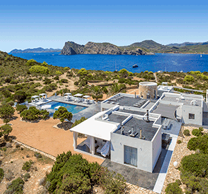
Illa de Tagomago is a private island off the east coast of Ibiza belonging to Spain.
Map of Illa de Tagomago, Balearic Islands, Spain
The etymology is likely from tagomago meaning "rock Mago" in reference to Mago Barca, a brother of the Carthaginian general Hannibal. In the Muslim era it was known as Taj Umayu.
It is 1,525 m long and 113 m wide. The island is rocky, with a port and a lighthouse in the extreme southeast. The Tagomago lighthouse was built in 1913 and is a landmark in the shipping routes from Ibiza to Palma de Mallorca and Barcelona. It is 86.3 m above sea level, and its height is 20.4 m.
The island is owned by Spanish entrepreneur Mariano Montero, and has a small tourist facility within which politicians and celebrities frequently visit.
References
Illa de Tagomago Wikipedia(Text) CC BY-SA