
Province Vorarlberg River mouth 1,811 m (5,942 ft) Length 72 km River system Rhine | Main source 2,240 m (7,350 ft) Progression Rhine → North Sea Country Austria | |
 | ||
Similar Rhine, Bregenzer Ach, Alps, Radolfzeller Aach, Lauter | ||
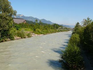
The Ill (all capitals: ILL) is a 72 km long tributary of the Rhine in the western Austrian province of Vorarlberg.
Map of Ill, Gaschurn, Austria
It flows from the northern slopes of the Silvretta mountain range and then runs north-west through Vorarlberg. The Ill passes through the Montafon and Walgau valleys and the town Feldkirch. It joins the river Rhine a few kilometers northwest of Feldkirch ("Illspitz"), at the border with Switzerland. The Ill has several dams with hydroelectric power stations.
References
Ill (Vorarlberg) Wikipedia(Text) CC BY-SA