
Counties Jefferson GNIS feature ID 204713 Zip code 80453 Local time Friday 3:09 AM | Time zone MST (UTC-7) Elevation 1,969 m Population 252 (2010) | |
 | ||
Weather 1°C, Wind W at 13 km/h, 60% Humidity | ||
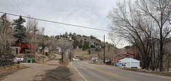
Idledale is a census-designated place, unincorporated community, and a U.S. Post Office in Jefferson County, Colorado, United States. The Idledale Post Office has the ZIP Code 80453.
Contents
Map of Idledale, CO, USA
History
Originally called Starbuck Heights, the town was almost washed out by a storm in 1933. When it was rebuilt, the town became known as Idledale.
Geography
Idledale is located at 39°39′57″N 105°14′39″W (39.665971,-105.244045).
References
Idledale, Colorado Wikipedia(Text) CC BY-SA