
Highest elevation 500 m (1,600 ft) | Elevation 500 m | |
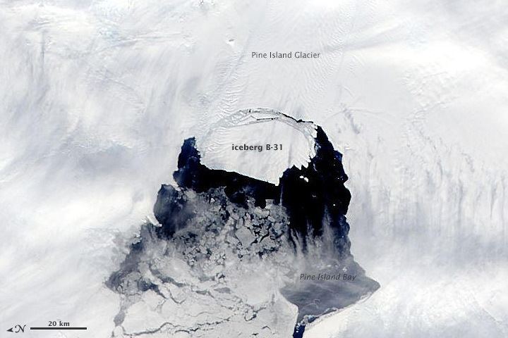 | ||
Iceberg B31 is a large iceberg that formed in November 2013, when it separated from the Pine Island Glacier. B31 is heading into the Antarctic ocean, which may have possible repercusions for international shipping. Soon it would not be possible to track the iceberg as the winter darkness completely hides it. The ice island is 20 miles by 12 miles and 500 m of height. It was first observed by Moderate Resolution Imaging Spectroradiometer (MODIS), an instrument on NASA's Terra and Aqua satellites of NASA.
References
Iceberg B31 Wikipedia(Text) CC BY-SA