
Main source West Fork Basin size 266 sq mi (690 km) Basin area 688.9 km² Country United States of America | 2nd source East Fork Length 58 km Mouth Meramec River | |
 | ||
River mouth Meramec River, about a mile upstream of Onondaga Cave State Park Discharge Average rate:
310 cu ft/s (8.8 m/s) | ||
Huzzah Creek ( /ˈhuːzɑː/) is a 35.8-mile-long (57.6 km) clear-flowing stream in the southern part of the U.S. state of Missouri. According to the information in the Ramsay Place Names File at the University of Missouri, the creek's name "is evidently derived from" Huzzaus, one of the early French versions of the name of the Osage people.
Map of Huzzah Creek, Liberty Township, MO, USA
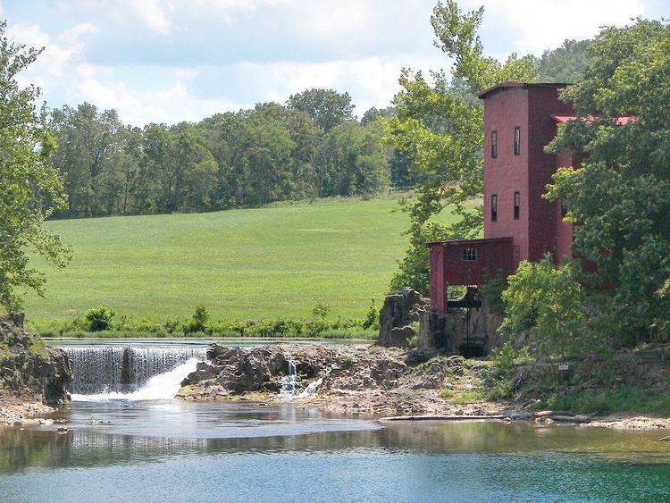
The Huzzah's headwaters are in the Mark Twain National Forest in northern Reynolds County. It flows northward through the Missouri Ozarks, roughly paralleling the course of Courtois Creek to its east, until it enters the Meramec River shortly after passing under the Crawford County Highway E bridge. Along its course it flows through the Dillard Mill State Historic Site and, near its confluence with the Meramec, the 6,225-acre (2,519 ha) Huzzah Conservation Area.
The creek is popular for camping, canoeing, kayaking, and rafting. It is surrounded by limestone bluffs and stands of native pine, oak, and hickory trees; and at normal water levels it has no sections of difficulty greater than grades I and II. The St. Louis Riverfront Times cited the creek as the "Best River for Float Trips" in 2011.