
Country United States Discharge 13.28 m³/s Mouth Lake Erie | Basin size 908 sq mi (2,350 km) Length 209 km Source Huron Swamp | |
 | ||
Main source Huron Swamp south of Andersonville, Michigan
1,001 ft (305 m) River mouth Lake Erie southeast of Rockwood, Michigan
571 ft (174 m) Bridges Delhi Bridge, Bell Road Bridge, Waltz Road-Huron River Bridge Cities Ann Arbor, Ypsilanti, Dexter, Flat Rock, Belleville, Rockwood Similar Lake Erie, Huron–Clinton Metroparks, Gallup Park, Belleville Lake, Kensington Metropark | ||
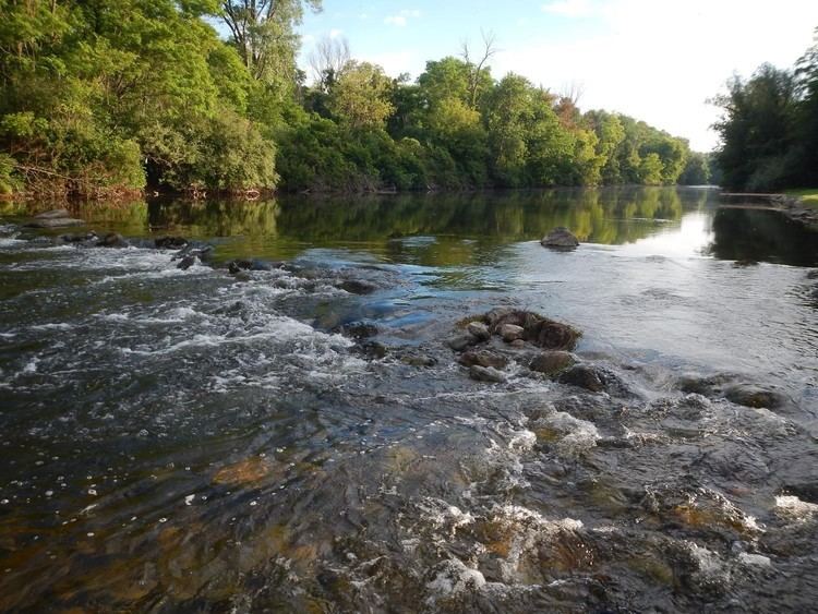
The Huron River is a 130-mile-long (210 km) river in southeastern Michigan, rising out of the Huron Swamp in Indian Springs Metropark in White Lake Township in northern Oakland County and flowing into Lake Erie on the boundary between Wayne County and Monroe County. In addition to thirteen parks, game areas, and recreation areas, the river passes through the cities of Dexter, Ann Arbor, Ypsilanti, Belleville, Flat Rock and Rockwood.
Contents
- Map of Huron River Berlin Charter Twp MI USA
- History
- Floods
- Tributaries
- Path
- Historical name confusion with Clinton River
- References
Map of Huron River, Berlin Charter Twp, MI, USA
The Huron River is a typical Southeast Michigan stream; mud banks, slow stream flow and a low gradient define this river. It runs through the following counties, in order from the headwaters to its mouth: Oakland, Livingston, Washtenaw, Wayne, and Monroe. There are 24 major tributaries totaling about 370 miles (600 km) in addition to the mainstream. The Huron River watershed drains 908 square miles (2,350 km2). It is the only state-designated Country-Scenic Natural River in southeast Michigan. This includes 27.5 miles (44.3 km) of the mainstream, plus an additional 10.5 miles (16.9 km) of three tributaries.
The river was named after the Huron band of Native Americans who lived in the area. In Native languages, it was called cos-scut-e-nong sebee or Giwitatigweiasibi. It was part of a Native American trade route.
The river has many dams, 19 on the mainstream and at least 96 in the entire system. Most dams are only a few feet high, built to slightly increase and maintain water levels in existing lakes to provide drought protection and flood control, a use that is now environmentally controversial. However, at least a dozen dams were built for mill or hydroelectric power and several formed large new lakes behind them. Some of these on the Huron River mainstream are Kent Lake, Barton Pond, Argo Pond, Ford Lake, Belleville Lake, and Flat Rock Pond.
The Huron River flows through numerous parks and is a prime canoeing river with a generally slow current and only a few minor rapids or obstructions, except for the short Delhi rapids which is runnable by experienced canoeists and kayakers except during low water.
The river is heavily fished by sportsmen for rock bass, sunfish, bluegill, black crappie, white bass, smallmouth bass, largemouth bass, northern pike, walleye, catfish, trout, muskie, and below Belleville Dam, Coho salmon, Chinook salmon, and Steelhead. Suckers and carp are also common fish in the river.
In 2009, faculty and students from the University of Michigan produced "Mapping the River," a multimedia presentation combining dance, poetry, music, and projected images which explored the role of the Huron in communities along it.
History
The Huron River was declared navigable by Congress in the 19th century, and for a time, there was flat-boat traffic from Ypsilanti to Lake Erie. This was discontinued as the railroads penetrated the region and milling developed along the river. By the 1880s, the Huron River was considered peculiar among the rivers in the region because it was intensely exploited for water-powered manufacturing. The census reported a total of 17 developed mill dams on the river, many providing power to multiple mills. Flour milling dominated, but there were also sawmills and woolen mills. As the 20th century began, the Detroit Edison Company and Ford Motor Company began acquiring and developing dams along the river for electric power.
Floods
Notable floods have occurred on March 23, 1904, March 14, 1918, June 24, 1968, and March 15, 1982.
Tributaries
Significant tributaries of the Huron River are listed below, in order of progression upstream. Sub-tributaries are indented below their parent watercourse.
Path
The river flows through the following parks and cities in this order starting from the headwaters:
Historical name confusion with Clinton River
The Clinton River was also known as the Huron River until 1824. Although the Clinton River drains into Lake St. Clair north of Detroit, it is also located in southeast Michigan and shares about 10 miles (16 km) of watershed boundary with the Huron River system. The Clinton River was renamed on July 17, 1824, by the Michigan Territorial Council to avoid confusion between the two rivers.