
 | ||
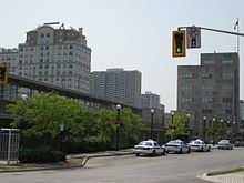
Hunter Street is a Lower City collector road in Hamilton, Ontario, Canada. It is a one-way street (Westbound) that starts West of Locke Street at Hill Street Park and ends two blocks East of Victoria Avenue at Emerald Street. (Hunter Street is a two-way street between Victoria and Emerald Streets.)
Contents
- Map of Hunter St Hamilton AL 35570 USA
- History
- Landmarks
- Communities
- Roads that are parallel with Hunter Street
- Roads that cross Hunter Street
- References
Map of Hunter St, Hamilton, AL 35570, USA
History
Hunter Street is named after Peter Hunter Hamilton (1800–1857), landowner and businessman and half brother of city founder George Hamilton. Originally, sections of Hunter Street were called William Street after King William IV and Peel Street after the British PM, Sir Robert Peel.
Central Public School building on Hunter Street West was built in 1853. This school was built to accommodate 1,000 students, was the largest graded school in Upper Canada, and became the only public school in Hamilton, at the time of its opening in 1853. The building's original final proportioned classical design, by the firm Cumberland & Ridout, was extensively remodelled in 1890 by the Hamilton architect, James Balfour. His alterations, including a steeply pitched roof, certain round arched windows and a heightened central tower, created an edifice in conformity with the late Victorian tastes. The building is designated under the Ontario Heritage Act.
Landmarks
Note: Listing of landmarks from West to East.
Communities
Note: Listing of neighbourhoods from West to East.
Roads that are parallel with Hunter Street
Lower City roads:
Niagara Escarpment (Mountain) Roads:
Roads that cross Hunter Street
Note: Listing of streets from West to East.