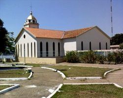
Founded February 4, 1890 Elevation 90 m Population 45,954 (2012) Number of airports 1 | Demonym humaitaense Time zone AST (UTC-4) Area 33,072 km² Local time Thursday 5:57 AM | |
 | ||
Weather 24°C, Wind N at 5 km/h, 95% Humidity | ||
Humaitá is a municipality located in the Brazilian state of Amazonas. Its population was 45,954 (2012) and its area is 33,072 km². The city is located on the banks of the Madeira River.
Map of Humait%C3%A1 - State of Amazonas, Brazil
The city is served by Humaitá Airport. The Trans-Amazonian Highway passes through the city.
The municipality contains part of the strictly-protected Cuniã Ecological Station, an area of cerrado savanna parkland. It contains 5% of the Campos Amazônicos National Park, a 961,318 hectares (2,375,470 acres) protected area created in 2006 that protects an unusual enclave of cerrado vegetation in the Amazon rainforest. It also contains the Humaitá National Forest, a 473,155 hectares (1,169,190 acres) sustainable use conservation unit created in 1998.
References
Humaitá, Amazonas Wikipedia(Text) CC BY-SA
