
 | ||
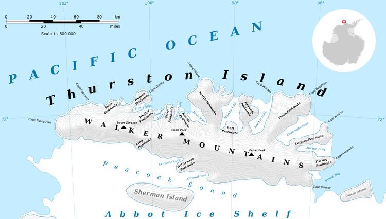
Hughes Peninsula (71°54′S 100°17′W) is an ice-covered peninsula about 18 nautical miles (33 km) long, lying west of Henry Inlet on the north side of Thurston Island, Antarctica. It was plotted from air photos taken by U.S. Navy Operation Highjump in December 1946, and was named by the Advisory Committee on Antarctic Names for Jerry Hughes, a photographer's mate with the U.S. Navy Bellingshausen Sea Expedition in February 1960, who took aerial photographs of Thurston Island from helicopters.
Maps
References
Hughes Peninsula Wikipedia(Text) CC BY-SA