
Elevation 310 m | ||
 | ||
Location Victoria Land, Antarctica | ||
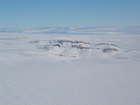
Hughes Bluff is a conspicuous rock and ice bluff, 310 metres (1,020 ft) high, along the south side of David Glacier, 6 nautical miles (11 km) west of Cape Reynolds, in Victoria Land, Antarctica. It was mapped by the United States Geological Survey from surveys and U.S. Navy tricamera aerial photography, 1957–62, and was named by the Advisory Committee on Antarctic Names for Garrett A. Hughes, a United States Antarctic Research Program researcher (cosmic radiation) at McMurdo Station in 1966.
Map of Hughes Bluff, Antarctica
References
Hughes Bluff Wikipedia(Text) CC BY-SA