
Area code(s) 262 Elevation 308 m | Time zone Central (CST) (UTC-6) GNIS feature ID 1566787 Local time Wednesday 8:48 PM | |
 | ||
Weather -4°C, Wind SW at 8 km/h, 48% Humidity | ||
Spring 2016 grounds tour of holy hill national shrine of mary hubertus wisconsin
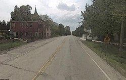
Hubertus is an unincorporated community in the village of Richfield and the town of Erin in Washington County, Wisconsin, United States. The community was named after the previous parish St. Hubert's (now joined with St. Gabriel).
Contents
- Spring 2016 grounds tour of holy hill national shrine of mary hubertus wisconsin
- Map of Hubertus WI USA
- Visitor attractions
- References
Map of Hubertus, WI, USA
Visitor attractions
Holy Hill Shrine is located in the area.
References
Hubertus, Wisconsin Wikipedia(Text) CC BY-SA